Arctic Environments/Marine Waters/Ecozones/Arctic Archipelago Marine Ecozone
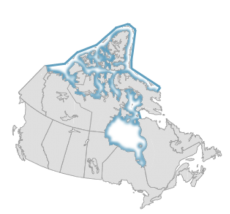
The Arctic Archipelago Marine Ecozone is a vast area of ocean stretching from Greenland to Alaska, containing 94 major islands and 36,469 minor islands.[1] It is uniquely comprised of interconnecting bays, fjords, and channels which provide a more sheltered marine habitat than the open ocean. The Arctic Archipelago is a truly polar environment with 24 hour nights in winter and an average annual temperature of -20°C.[1]
This ecozone is covered in a blanket of ice averaging 1.5 - 2 m thickness over winter, except for the polynyas where currents and upwellings prevent ice formation. In the summer, the ice breaks up into sections, separated by channels of open water, called leads. Polynyas and leads create important transportation corridors for many of the mammals in the area, and are prime fishing spots for sea birds. These corridors are vital for seasonal migration to the south for many animals in the Arctic Archipelago, since winter temperatures average a frigid -30°C.[1] Ice cover during late summer has been thinner in recent years, resulting in the expansion of large areas of these ice-bound passageways due to climate change.
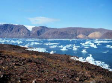
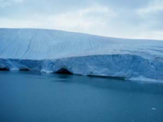
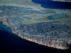
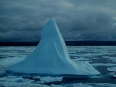
This ecozone is unique because of its numerous channels and coastlines. Around Baffin Island, fjords and cliffs are common along the coast. This contrasts with the rolling hills and coastal plains near Melville Sound. The water depth also varies throughout the region, ranging from less than 100 m to 600 m, with an increase in depth as the Arctic Archipelago merges with the Northwest Atlantic Ecozone. The region has particularly low tidal ranges, but currents can be strong in certain narrow corridors, such as the Bellot Fury and Hecla straits. Sections of the glaciers and large ice caps covering many of the islands frequently break off into the waters. The resulting scenery is a mosaic of ice floes, icebergs, ice islands, and open water.
Sea ice reflects most of the sun's radiation which could be used by vegetation for photosynthesis. As a result, plant life is very limited in this ecozone, incrementally decreasing north of the mainland. During the summer months, however, the long hours of light and higher temperatures thin the ice, allowing phytoplankton blooms. Some algae, such as diatoms, are able to live attached to the underside of ice. There are larger blooms near polynyas, as open water allows more solar radiation to be absorbed so the nutrient supply is increased. There is, however, little or no intertidal vegetation because of ice scour. Insects are also a very important component of this ecozone, with about 700 unique species identified.
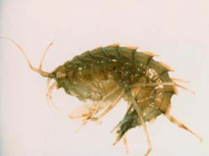
A diverse community of marine mammals and birds visits this ecozone, migrating south as ice solidifies in the winter, and using the channels that form as ice breaks up in the spring to travel north. Migratory birds, including tundra swans, fulmars, and arctic terns, commonly visit this area when open water is present. Approximately 20 species of land mammals live in the archipelago, where polar bears utilize the open water to hunt, while seals use leads for breathing holes as they search for food.[1] Arctic cod thrive in this ecozone, feeding on the many invertebrates, such as molluscs, crabs, and planktonic crustaceans, while being fed upon by whales and seals.
References
- ↑ 1.0 1.1 1.2 1.3 The Canadian Encyclopedia. (2015). Arctic Archipelago. Retrieved from https://www.thecanadianencyclopedia.ca/en/article/arctic-archipelago.
